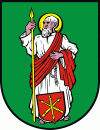
Tomaszów Lubelski (Tomaszów Lubelski)
 |
The town was founded at the end of the 16th century by Jan Zamoyski as Jelitowo. It is known by its current name since 1613 when it was renamed after Zamoyski's son, Tomasz. It obtained its city charter in 1621. It was administratively located in the Bełz Voivodeship in the Lesser Poland Province of Poland. The area around the city saw serious fighting in 1914 during World War I.
On September 17–26, 1939, during the joint German-Soviet invasion of Poland which started World War II, the Battle of Tomaszów Lubelski was fought between Poland and Germany. The town was bombed by the Germans and eventually found itself under German occupation. The town's Jewish community, which numbered over 5,600 in 1939 at the start of the war, was persecuted by the occupiers in the Holocaust. The Nazi Germans first placed the Jews in a ghetto established in the town, then exterminated them in 1942 at Bełżec extermination camp located a few km. south of the town. The Jewish community ceased to exist.
In 1975–1998, the town was administratively located in the Zamość Voivodeship.
Map - Tomaszów Lubelski (Tomaszów Lubelski)
Map
Country - Poland
 |
 |
| Flag of Poland | |
Poland has a temperate transitional climate and its territory traverses the Central European Plain, extending from Baltic Sea in the north to Sudeten and Carpathian Mountains in the south. The longest Polish river is the Vistula, and Poland's highest point is Mount Rysy, situated in the Tatra mountain range of the Carpathians. The country is bordered by Lithuania and Russia to the northeast, Belarus and Ukraine to the east, Slovakia and the Czech Republic to the south, and Germany to the west. It also shares maritime boundaries with Denmark and Sweden.
Currency / Language
| ISO | Currency | Symbol | Significant figures |
|---|---|---|---|
| PLN | Polish złoty | zÅ‚ | 2 |
| ISO | Language |
|---|---|
| PL | Polish language |


